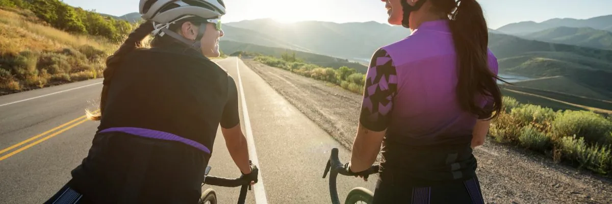
If you love cycling, Gran Canaria is the destination you've been looking for. This island not only has an enviable climate all year round, but also breathtaking landscapes that make it a true paradise for cyclists.
The aim of this article is to offer you a guide to the best cycling routes in Gran Canaria. We have selected the most interesting routes based on difficulty, type of terrain and distance, so that you can find the perfect route for you. Here we go!
MTB Routes Gran Canaria
Route 1: Pico de las Nieves
- Difficulty: High
- Terrain: Mountainous, technical trails
- Length: 50 km
- Cumulative difference in altitude: 1,900 m
Description
The Pico de las Nieves route is one of the most demanding routes in Gran Canaria, perfect for experienced cyclists. This route starts in San Bartolomé de Tirajana and climbs up to Pico de las Nieves, the highest point on the island, at 1,949 metres above sea level.
Starting point
San Bartolomé de Tirajana, south-central Gran Canaria.
Path
- Steady ascent: 25 km of continuous ascent with a cumulative difference in altitude of 1,900 metres.
- Varied terrain: country roads and technical trails, with rocky sections and narrow stretches.
- Steep slopes: especially on the last part of the ascent.
Final point
Pico de las Nieves, at an altitude of 1,949 metres.
Return
Descent along the same route to San Bartolomé de Tirajana, completing a circular route of 50 km.

Technical recommendations
- Equipment: Mountain bike in good condition, helmet, and basic tools.
- Supplies: Water and food sufficient for the entire route.
- Clothing: Suitable for temperature changes in the mountains.
Route 2: Guayadeque Ravine
Difficulty: Medium
Terrain: Mixed, footpaths and country roads
Length: 30 km
Cumulative difference in altitude: 800 m
Description
The Barranco de Guayadeque route is perfect for intermediate cyclists looking for a varied experience. This route starts in the village of Agüimes and continues into the interior of the ravine, offering a mix of country roads and trails.
Starting point
Agüimes, southeast of Gran Canaria.
Path
- Mixed terrain: combination of asphalt and dirt tracks.
- Moderate ascent: 15 km of ascent with a cumulative difference in altitude of 800 metres.
- Natural landscapes: lush vegetation and rock formations.
- Inhabited caves: passing through areas with caves that are used as dwellings and restaurants.
- Highlight: Ermita de San Bartolomé de Guayadeque, an ideal place for a break.
Return
Descent along the same route to Agüimes, completing a circular route of 30 km.
Technical recommendations
- Equipment: Mountain bike in good condition, helmet, and basic tools.
- Supplies: Water and food sufficient for the entire route.
- Clothing: Suitable for temperature changes.
Road cycling routes in Gran Canaria
Route 1: Village Road
Difficulty: High
Terrain: Asphalt, curves and slopes
Length: 70 km
Accumulated difference in altitude: 1.500 m
Description
The Carretera de la Aldea route is one of the most spectacular routes in Gran Canaria, for well-prepared road cyclists. This 70 km route has many curves and slopes; it is an important technical and physical challenge.
Starting point
Agaete, northwest of Gran Canaria.
Path
- Initial ascent: From Agaete to the Mirador del Balcón, with an accumulated difference in altitude of 1,000 metres in the first 30 km.
- Terrain: Tarmac road in good condition, with numerous bends and changes in gradient.
- Points of interest: Panoramic views of the Atlantic Ocean and the cliffs in the west of the island.
- Steep slopes: especially on the stretch towards the Mirador del Balcón and then towards La Aldea de San Nicolás.
- Highlight: Mirador del Balcón, with spectacular views of the coast and the ocean.
Return
Descent along the same route to Agaete, completing a circular route of 70 km.
Technical recommendations
- Equipment: Road bike in good condition, helmet, and basic tools.
- Supplies: Water and food sufficient for the entire route.
- Clothing: Suitable for temperature changes and variable weather conditions.
Route 2: Back to the island
Difficulty: High
Terrain: Asphalt, long distance
Length: 200 km
Cumulative difference in altitude: 3,500 m
The tour of Gran Canaria is a major challenge, so you need to be well prepared. This 200 km route passes through every corner of the island, combining coastal stretches with the mountainous interior.

Starting point
Las Palmas de Gran Canaria.
Path
- Terrain: Asphalt road in good condition all along the island.
- Route:
- North and west: Starting in Las Palmas, head north on the GC-2 through Agaete, continuing west to La Aldea de San Nicolas.
- Inland: From La Aldea, continue south and inland along the GC-200 and GC-210, passing through municipalities such as Mogán and San Bartolomé de Tirajana.
- South and east: From San Bartolomé, descend south to Maspalomas and follow the east coast along GC-500 and GC-1, returning to Las Palmas.
Gradient and slopes
- Total elevation gain: Approximately 3,500 metres, with several significant climbs and descents.
- Main slopes: Several long and steep climbs, especially in the mountainous interior.
Return
The route is circular, returning to the starting point in Las Palmas de Gran Canaria.
Technical recommendations
- Equipment: Road bike in excellent condition, helmet, and basic tools.
- Supplies: Enough food and water for a full day, with planned stops for resupply.
- Clothing: Suitable for temperature changes and different weather conditions, including sun protection.
Mixed routes (road and trails)
Route 1: Las Palmas - Tejeda
Difficulty: Medium
Terrain: Asphalt and rural roads
Length: 60 km
Accumulated difference in altitude: 1.500 m
Description
Accumulated difference in altitude: 1.500 m
Starting point
Las Palmas de Gran Canaria.
Path
- Terrain: Starts on urban tarmac road, passing through rural sections as you go inland.
- Route:
- Start: Departure from the centre of Las Palmas, following the GC-110 and GC-15 towards the southwest.
- Middle: You will pass through towns such as Tafira and Santa Brígida, where the urban landscape gives way to more rural areas.
- End: Ascent towards Tejeda, a picturesque village in the heart of the island, using the GC-600.
Gradient and slopes
- Total altitude gain: Approximately 1,500 metres.
- Moderate gradients: Steady but manageable climbs, especially in the last 20 km before reaching Tejeda.
Return
The descent follows the same route to Las Palmas, completing a circular route of 60 km.
Technical recommendations
- Equipment: Road or hybrid bike in good condition, helmet and basic tools.
- Supplies: Water and food sufficient for the entire route.
- Clothing: Suitable for temperature changes, especially in mountainous areas.
Route 2: Tafira - Bandama Caldera
Difficulty: Low
Terrain: Asphalt and easy trails
Length: 20 km
Cumulative difference in altitude: 400 m
Description
The route from Tafira to the Caldera de Bandama is perfect for cyclists looking for a short and accessible route with stunning scenery. This 20 km route combines tarmac roads with easy trails, ideal for a relaxed ride.
Starting point
Tafira, Gran Canaria.
Path
- Terrain: Tarmac road with a final stretch on an easy trail.
- Route:
- Start: Departure from the centre of Tafira, taking the GC-802 towards the north-east.
- Middle: Continue along the GC-4 and then the GC-802 towards the Caldera de Bandama.
- End: Gentle ascent to the Caldera de Bandama, a volcanic crater with breathtaking panoramic views.
Gradient and slopes
- Cumulative difference in altitude: Approximately 400 metres.
- Gentle slopes: Gradual ascent, especially in the final stretch towards the caldera.
Return
Descent along the same route to Tafira, completing a circular route of 20 km.
Technical recommendations
- Equipment: Road or hybrid bike in good condition, helmet and basic tools.
- Supplies: Sufficient water for the route.
Clothing: Suitable for temperature changes, especially at higher elevations.
Cycling around Gran Canaria is an excellent way to get to know the island. At Scooter Bike Rental Maspalomas we offer you the possibility of renting a bike for your holidays or for the routes you want to do. We offer you the rental and also the advice you need, please contact us!